Experiencing the Best of Chiricahua National Monument on the Big Loop Trail
As far as National Park units go, Chiricahua is certainly impressive, but not the largest park you'll visit by a long shot. It's approximately 12000 acres, which is about a third of the size of another National Park that I consider to be relatively small, which is Bryce Canyon.
If you visit Chiricahua and drive to the top and view the park from a popular overlook such as Massai Point, you'll be able to survey the entire main section of the park from this one point.
Don't get me wrong. 12000 acres is impressively large when compared to a tiny speck like me. When you stand atop something like Massai Point and look down at the landscape below, you'll not be underwhelmed by any stretch of the imagination. But, it's also not so large that you couldn't circumnavigate the entire wilderness area in a single day or less.
Now enter the Big Loop trail. This trail offers you the opportunity to see almost everything worth seeing in the park, while still leaving a few hours to do something else, if you start early enough of course.
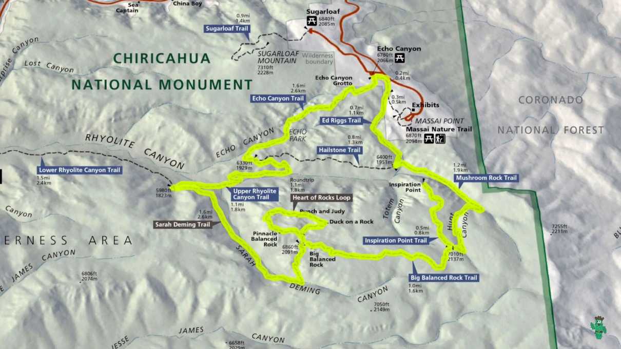
Take a look at the highlighted map below.
I highlighted the route that the Big Loop follows. There is information about it on the Park Service's official hiking guide page, and you can also download the map above by clicking here, although that version is not highlighted like the one above.
Overall, the Big Loop is just shy of ten miles long. You'll begin your adventure at the Echo Canyon trailhead. You could technically hike it in either a clockwise or counter clockwise direction, but I decided to hike the trails in the order they are listed on the Chiricahua Hiking guide, which is the counter clockwise direction.
In retrospect, I feel that I chose the direction wisely, because I was able to enjoy the Echo Canyon Trail portion walking down hill, and for me, that is one of the best parts of the hike. Best enjoyed while not out of breath, and you'll constantly have the beautiful landscape below within your line of sight.
The first thing you may notice as you start your hike at the Echo Canyon trailhead is a sign that warns you of the many dangers present in this area. These range from hazardous wildlife such as mountain lions, black bears and rattlesnakes, to abruptly changing weather conditions, cliffs, and cacti.
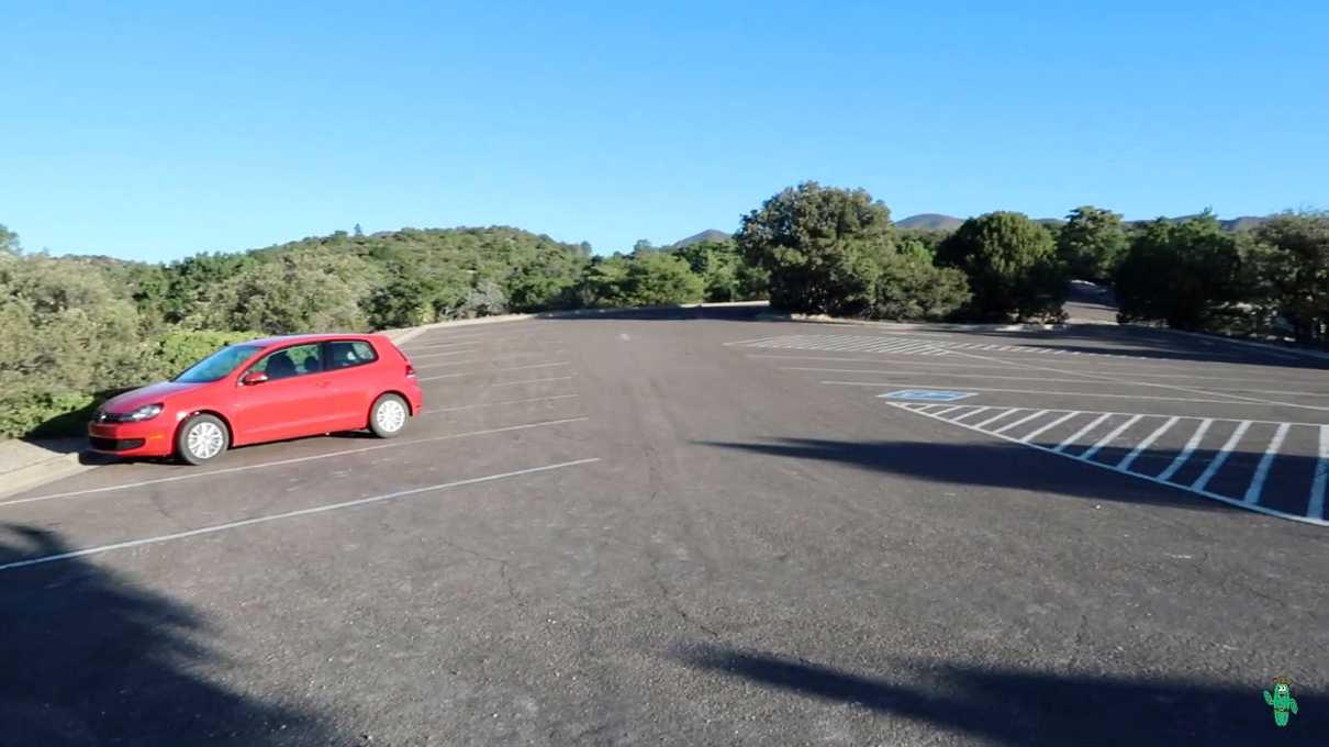
On the morning that I set out to do this, I arrived at the trailhead within the 7 in the morning hour, and mine was the only car in the parking lot.
I hadn't seen a single soul on the entire drive to this point, and the campground was not a capacity, so this day had the makings of being a somewhat lonely day out on the trail. Seeing all the warnings about the various hazards did indeed make me a little nervous, especially since I was hiking solo. I'm smart enough to know, however, that seeing many of the creatures mentioned is extremely unlikely, so at least I had statistics on my side! But, it's always recommended to not hike alone and always be sure to let someone know what you plan on doing. I did the latter, but did not have a choice concerning the first point if I wanted to experience this "wonderland of rocks" as it is often called.
It was a beautiful, cloudless morning. The moon was still clearly visible in the sky. As mentioned earlier, my plotted route had me start on the Echo Canyon trail.
This trail is magnificent, and beautifully engineered. It cuts through dense rock spires, giving you an up close and personal look at the rhyolite rock formations... the left overs of a volcanic eruption that occurred over 27 million years ago.
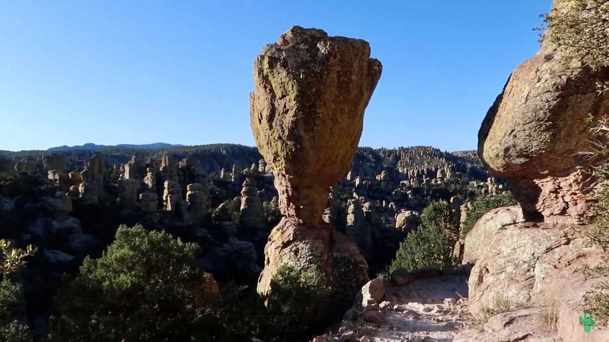
There are a couple places you can hike in Chiricahua that get you up close to the beautiful hoodoos, but few can beat what you will experience on the Echo Canyon trail.
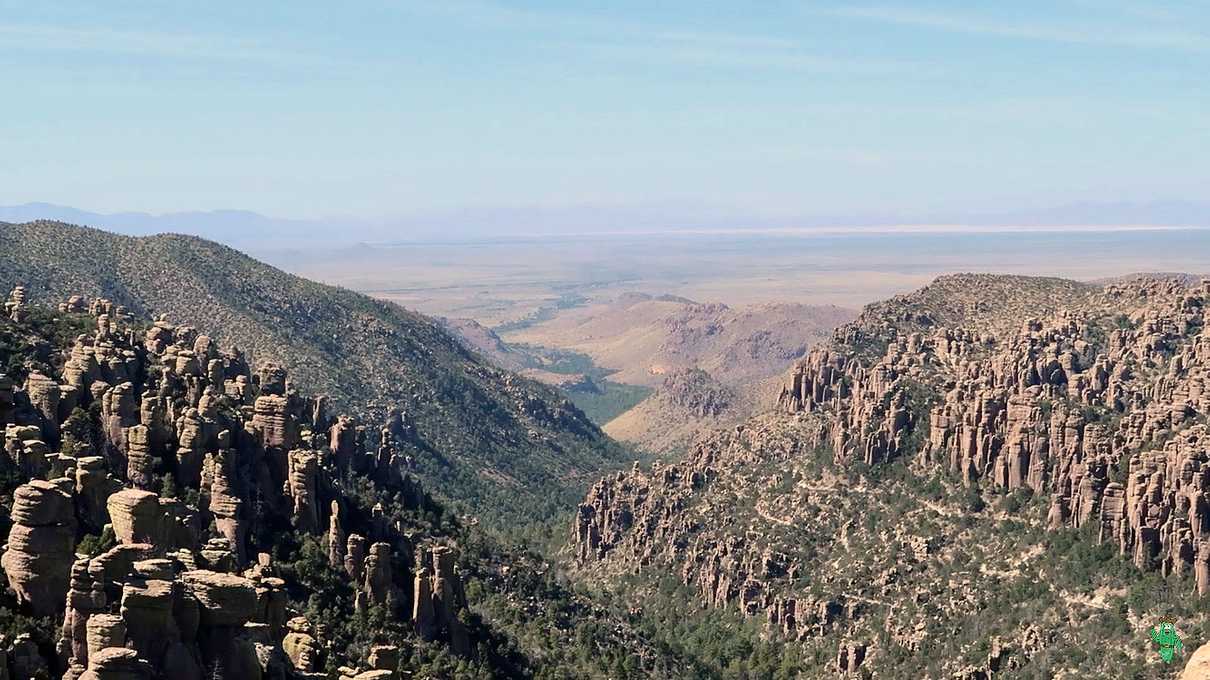
Not only do you get to see some amazing rocks, the views coming down this trail are nothing short of breathtaking.
As you progress downward through the Echo Canyon Trail and onto the Upper Rhyolite trail, you'll transition from exposed, rocky surfaces with sparse vegetation, to the deep shade of a thick forest. This is a great example of how abruptly the flora can change in what is known as a sky Island. Chiricahua is a prime example of a sky island, and you can see clearly see this from the higher regions of the park as you look out at the surrounding desert grasslands down below. A sky island is mountainous region that arises out of flat lowlands and hosts significantly different habitation zones than the lowland regions.
The Upper Rhylolite and Sarah Deming trails will take you through one such habitation zone... the dense forest. Hard to believe that a few mere miles away is seemingly endless, dry, barren grassland.
Eventually you'll emerge from the forest and start ascending back into the land of rock spires.
Approximately where the Sarah Deming trail ends and the Big Balanced Rock trail begins is the start of the Heart of Rocks loop trail. The Heart of Rocks may be the most popular place to visit in the park, but I'll not be writing about it here because I wrote a devoted piece describing that along with a video. But, needless to say, you don't want to pass the Heart of Rocks by, because it may represent the best of Chiricahua.
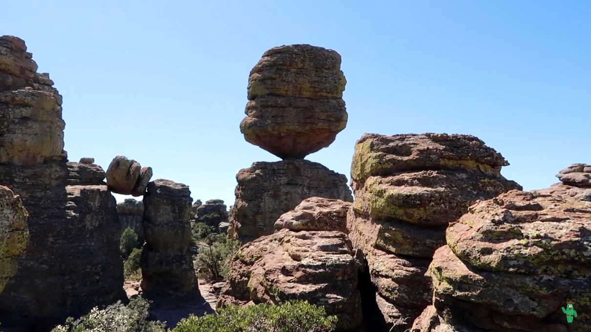
Also not far from this point is another popular sight... Big Balanced Rock. This impossibly balanced rock looks like something straight out of a Looney Tunes cartoon.
I had visions of the Roadrunner attempting to pry the large rock loose onto Wile E. Coyote who would be standing below it.
This area around Big Balanced Rock has some fine hoodoo specimens that you can get up close and personal with, but eventually, you'll need to keep heading up the trail.
And I won't lie. Aside from enjoying seeing the plants abruptly change again to those more suitable for a more arid, higher elevation climate, the majority of the Big Balanced Rock trail was among the more sparse of the Big Loop. Not too much to see one you proceed past Big Balanced Rock and a few remaining hoodoos.
That is, until you reach a sign that points you in the direction of a short spur trail dubbed Inspiration Point.
That being my first time hiking these trails, I honestly did not know what to expect at Inspiration Point. The name kind of gives away that there might be something inspiring to look at, and it is technically part of the Big Loop, so the completionist in me had to get it done like all the rest.
And I'm so glad that I did. This was easily the best overlook that I had visited on my trip. From up here, you get a complete view of the park from high up above, and can see the barren desert grasslands off in the distance, giving you the best representation of what a sky island is.
As with my entire day, there was not a single person around. I had only run into three people at the Heart of Rocks Loop. I had the entire view point to myself, and decided this would be an excellent place to hang out for a while, eat some lunch and enjoy the view.
From Inspiration Point you will end up descending into a canyon again, reentering deep shaded forests. Eventually you'll reascend among more beautiful rock spires and head back up to the parking lot.
Overall, I would say that my three favorite places on the Big Loop, in no particular order, are the Heart of Rocks Loop, the Echo Canyon trail and Inspiration point. Every trail has something unique to experienced however, whether it is beautiful forests or entertaining rock formations.
The best part of the Big Loop is, if you do this, you will have the satisfaction of having seen virtually the entire core section of the park. The only trails you do not hike are the Hailstone Trail and the Lower Rhyolite Canyon trail (the one that goes back to the visitor center).
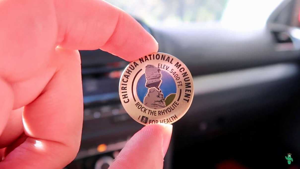
I completed the hike by mid afternoon, leaving plenty of time to go view other overlooks or check out a sight like Faraway Ranch. As for me, I headed back to the visitor center to claim a pin for hiking over 5 miles of trails, which is part of a promotional thing some of the National Park units are doing.
You'll of course need to prove that you hiked over 5 miles, which is easily done by taking pictures of the trailhead signs you will pass in the park. The Big Loop is twice the required length, so it was easy to qualify!
As of the time of this writing, the website still shows this promotion running at Chiricahua, so be sure to visit sometime soon and claim yours! It's a nice pin!
As always, we made a video documenting the entire journey from the start of the hike to claiming my reward, so if you want to experience the entire journey in more detail check it out!
